San Francisco Police Department announces a new map of boundaries for 10 police stations

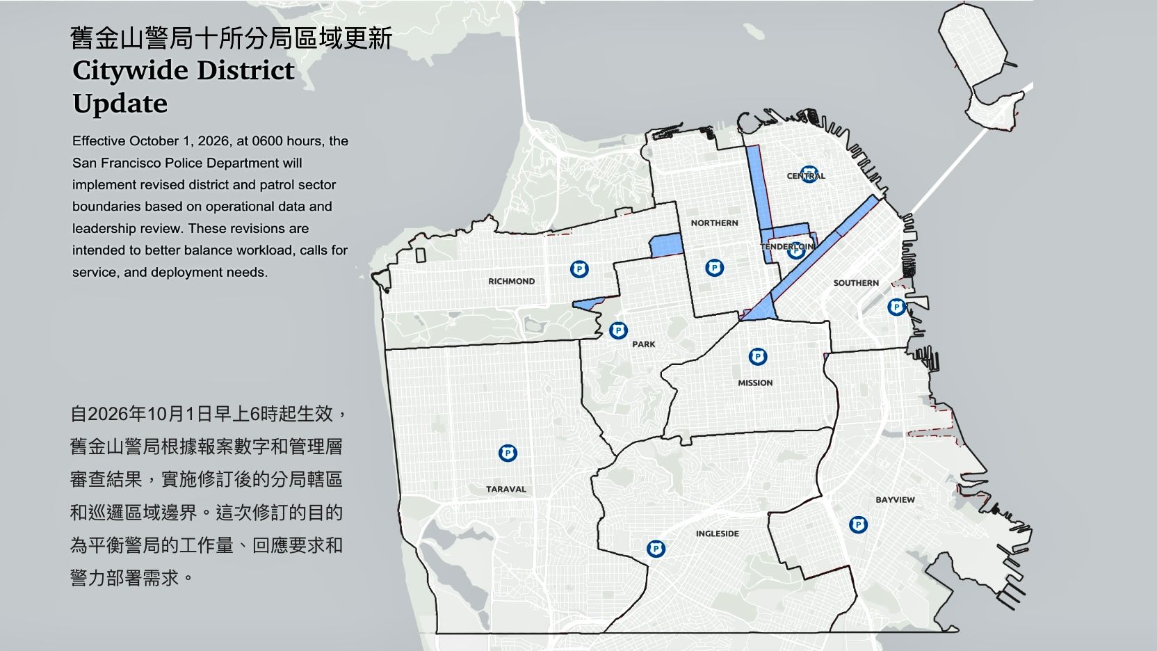
SAN FRANCISCO — The San Francisco Police Department (SFPD) implemented a new police jurisdiction map with newly-redrawn boundaries for all 10 police stations to better respond to emergency calls and balance the police officer workforce.
The new map of 10 police stations takes effect starting October 1. This is also the first time in 11 years the SFPD has established new boundaries for all 10 stations in the City based on the latest population projection of 826,079 for 2025. The 2020 Census count for the San Francisco citywide population was 873,965.
Under the City Charter, the SFPD must review district station boundaries every 10 years to improve police services and efficiency. This is the first new map of boundaries for all 10 police stations since 2015.
Under former Police Chief Bill Scott, the SFPD held a series of community and focus group meetings in 2024 to listen to community members' concerns.
Factors considered for the boundary changes included population data, calls for service and arrests, police staffing, and community input.
According to the SFPD, following factors related to the pandemic in 2020 were considered when reevaluating police district boundaries, the decline in SFPD staffing numbers in recent years after the pandemic, changes to resident and non-resident populations especially in the downtown areas, and reported criminal incident data.
The San Francisco Police Commission approved the new SFPD district boundary map on November 4, 2025. The new map went into effect on October 1, 2026.
The adjustments in the new police boundary map impact six district stations, Central, Tenderloin, Northern, Southern, Richmond, and Park stations. The other four police districts will not change: Taraval, Bayview, Mission, and Ingleside stations.
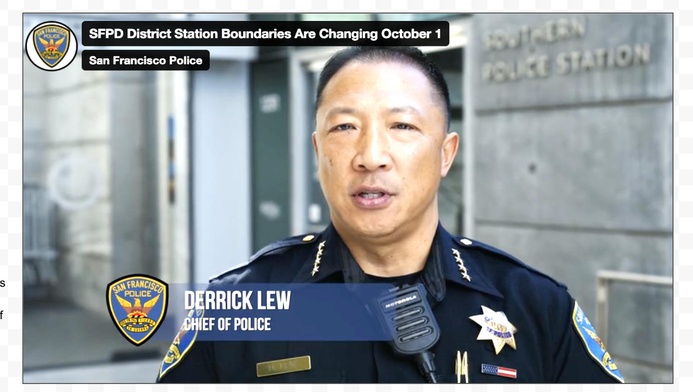
"The SFPD worked with our district station captains, command staff, city legislators, and community stakeholders to develop the best boundaries to meet the public safety needs of San Francisco," current Police Chief Derrick Lew said in a video announcing the new map.
"The SFPD does not anticipate the changes will cause any disruption to service. Instead, the new boundaries will help ensure patrol operations and are balanced when officers are responding to calls for service and incidents across the city," said Lew.
Major Changes in the new boundaries fall primarily in the Downtown's neighborhoods and commercial corridors, specifically the Market Street and Van Ness Avenue corridors.
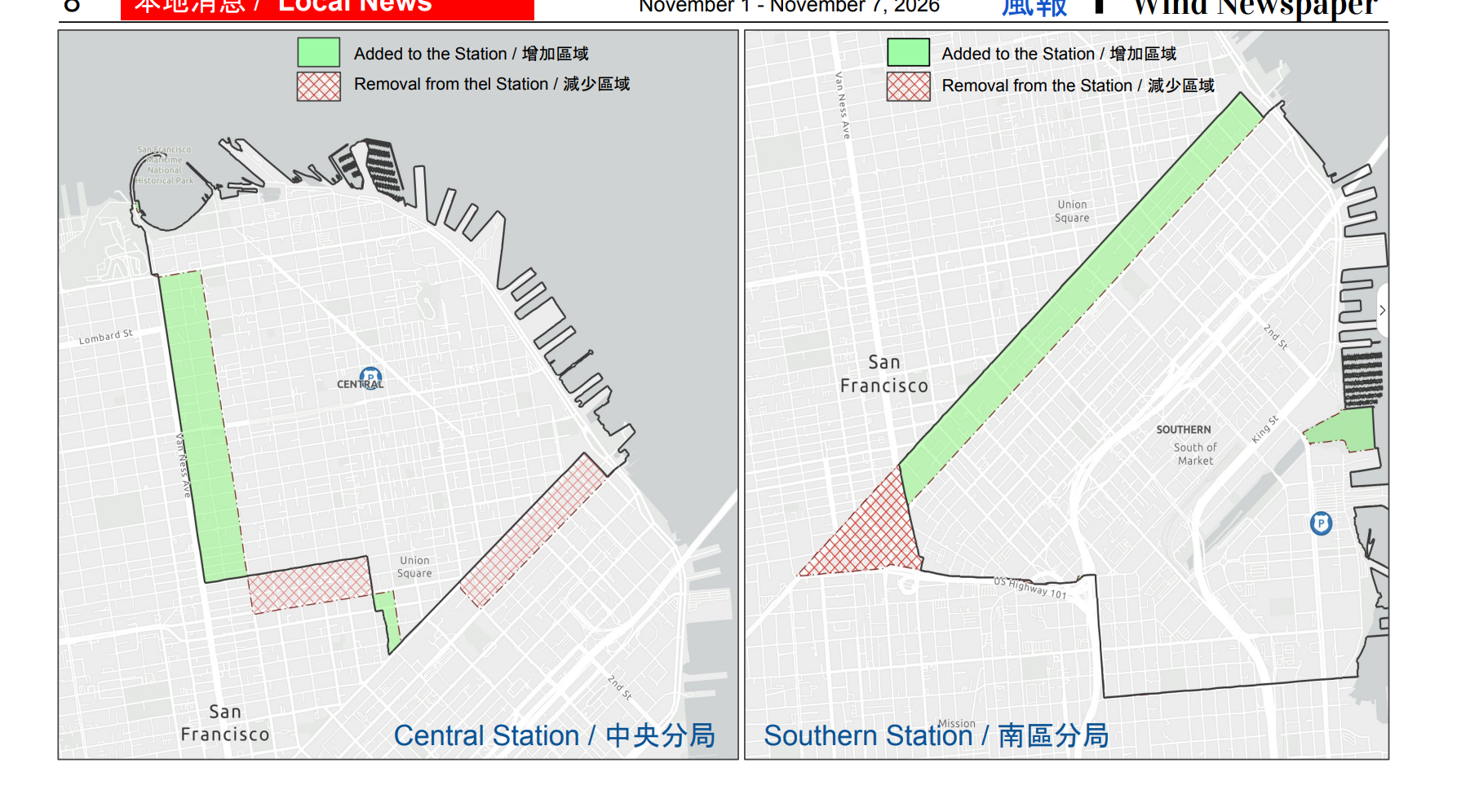
One major change relates to Southern Station. The new boundary has returned Market Street, Sixth Street, and areas in the South of Market to Southern Station, which now assumes responsibility for both sides of Market Street.
The other main boundary changes is at Central Station. The Van Ness business corridor, previously under Northern Station's boundary, is now mainly under Central Station's jurisdiction and partially in the Tenderloin Station. Central Station assumes responsibility for an additional area west to Van Ness Avenue.
Members of the Asian community who are retail workers along the Market Street corridor wonder if Southern Station is the best station to respond to incidents occurring on Market Street. They said officers from Southern Station might take longer time to arrive at Market Street due to frequent traffic gridlock on 3rd Street when games and events are happening at the Oracle Park and Chase Center.
- San Francisco Police Department announces a new map of boundaries for 10 police stations
- Edwin and Anita Lee Newcomer School reopened as a special education school for students in need
- Opinion: Save San Francisco — Vote No on Prop H
- Chinese community members say Prop H unfairly makes property owners pay for the San Francisco public transit agency’s shortfalls
- Proposition B authored by Supervisor Chen to create a Public Bank in San Francisco faces mounting opposition
- Opinion: City College opened doors for my family. Let’s keep them open.
- Opinion: Share the Great Highway. Keep San Francisco inclusive. Yes on G.
- A pre-election national AAPI poll: More AAPI adults trust Democrats over Republicans in handling issues